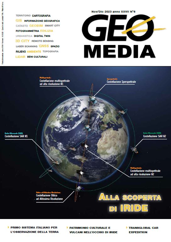
IRIDE: dai Servizi definiti dall’Utente alle Costellazioni di Satelliti, il primo Sistema Italiano end-to-end di Osservazione della Terra da Satellite
Abstract
In the context of the Italian PNRR (National Recovery and Resilience Plan), the M1C2 component, financed by the European Union (EU) through Next Generation EU-RFF and by the Presidency of the Council of Ministers of the Italian Republic through the Complementary Fund of the Presidency of the Council, is dedicated to digitalisation, innovation and competitiveness. It includes (in the M1C2.4.2 intervention) objectives dedicated to space activities for Earth Observation, to be achieved in the period 2022-2026, in particular the creation of an end-to-end Space System, called IRIDE, composed of: Upstream Segment, Downstream Segment and Service Segment toprovide geospatial services at national and European level.
The IRIDE System will, therefore, be one of the public assets developed in recent years by the investments of the PNRR and,
consistently, its design has been based on the needs expressed by the Italian National Authorities (whose collection is coordinated by the National Forum of Copernicus Users and represented in the “Needs Analysis” Annex to the National Earth Observation Plan) with the aim of contributing with the Geo-Spatial component to the development of products useful for the innovativeness and operation of the services provided by the Public Administration for the management of the territory,
emergencies and security.
Dowloads
Pubblicato
Fascicolo
Sezione
Licenza

Questo volume è pubblicato con la licenza Creative Commons Attribuzione - Non commerciale - Condividi allo stesso modo 4.0 Internazionale.
Gli autori che pubblicano su questa rivista accettano le seguenti condizioni:- Gli autori mantengono i diritti sulla loro opera e cedono alla rivista il diritto di prima pubblicazione dell'opera, contemporaneamente licenziata sotto una Licenza Creative Commons - Attribuzione che permette ad altri di condividere l'opera indicando la paternità intellettuale e la prima pubblicazione su questa rivista.
- Gli autori possono aderire ad altri accordi di licenza non esclusiva per la distribuzione della versione dell'opera pubblicata (es. depositarla in un archivio istituzionale o pubblicarla in una monografia), a patto di indicare che la prima pubblicazione è avvenuta su questa rivista.
- Gli autori possono diffondere la loro opera online (es. in repository istituzionali o nel loro sito web) prima e durante il processo di submission, poiché può portare a scambi produttivi e aumentare le citazioni dell'opera pubblicata (Vedi The Effect of Open Access).


