
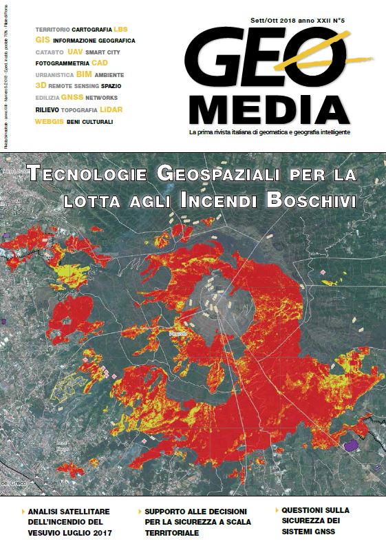
Studio comparativo tra lo stato dei luoghi prima e dopo l'incendio del Vesuvio tramite analisi satellitare
Keywords:
Landsat8, change detection, Vesuvio, wildfire, NDVI, NBR, temperaturaAbstract
At the half of July 2017, a big wildfire destroys a large area of Vesuvio and Mount Somma in the Vesuvio National Park. In this work, we have used Landsat8 multispectral set of images to study the area before and after the fire.
We have used tiles of 05-05-2017 and 24-07-2017. On the set of the images, we have applied the DOS for pass from TOA (Top Of the Atmosphere) to BOA (Bottom Of the Atmosphere). After this correction, we have applied
the Pansharpening with the aim of improving images resolution from 30m/px to 15m/px. Therefore we have estimate NDVI (Normalized Difference Vegetation Index), NBR (Normalized Burn Ratio) and temperature of
the ground before and after the fire.
References
Boer, M. (2008) Mapping burned areas and burn severity patterns in SW Australian eucalypt forest using remotely-sensed changes in leaf area index.
Bolstad, P.V. & Gower S.T. (1990) Estimation of leaf area index in fourteen southern Wisconsin forest stands using a portable radiometer. Tree Physiology.
Carlson, T. N. & D. A. Ripley (1997) On the relation between NDVI, fractional vegetation cover, and leaf area index.
Congedo, L. ” (2016) Semi-Automatic Classification Plugin User Manual.
Cristinzio G. & Bosso L. (2015) Serious damage by Diplodia africana on Pinus pinea in the Vesuvius national park (Campania region, southern italy).
Dainelli, N. (2011) L'osservazione della Terra – Telerilevamento.
Pat S. Chaver, (1996) junior - Image-Based Atmospheric Corrections - Revisited and Improved.
Pereira, J., (1999) "A comparative evaluation of NOAA-AVHRR vegetation indexes for burned surface detection and mapping”, in IEEE Transactions on Geoscience and Remote Sensing, vol. 37, pp. 217–226.
Wang, Q., Adiku, S., Tenhunen J., Granier A. (2005) On the relationship of NDVI with leaf area index in a deciduous forest site.
Telesca, L. & R. Lasaponara (2006) "Quantifying intra-annual persistent behavior” in Spot-Vegetation NDVI data for Mediterranean ecosystems of southern Italy.
Sander V., Lhermitte S. , Verstraeten W. W., Goossens R. (2011) Evaluation of pre/post-fire differenced spectral indices for assessing burn severity in a Mediterranean environment with Landsat ThematicMapper.
Weier J., Herring D. (2000) Measuring Vegetation (NDVI & EVI).
Downloads
Published
How to Cite
Issue
Section
License
Gli autori che pubblicano su questa rivista accettano le seguenti condizioni:- Gli autori mantengono i diritti sulla loro opera e cedono alla rivista il diritto di prima pubblicazione dell'opera, contemporaneamente licenziata sotto una Licenza Creative Commons - Attribuzione che permette ad altri di condividere l'opera indicando la paternità intellettuale e la prima pubblicazione su questa rivista.
- Gli autori possono aderire ad altri accordi di licenza non esclusiva per la distribuzione della versione dell'opera pubblicata (es. depositarla in un archivio istituzionale o pubblicarla in una monografia), a patto di indicare che la prima pubblicazione è avvenuta su questa rivista.
- Gli autori possono diffondere la loro opera online (es. in repository istituzionali o nel loro sito web) prima e durante il processo di submission, poiché può portare a scambi produttivi e aumentare le citazioni dell'opera pubblicata (Vedi The Effect of Open Access).

