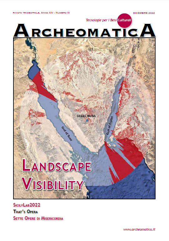
Could Egeria have seen the “Parthenion” sea from the Top of Mount Sinai?
The Landscape Visibility from the Top of Mount Sinai climbed by Egeria
Keywords:
ancient topography:, gis, qgis, viewshed analysis, egeriaAbstract
At the meeting organized in Novara (Italy) by the Nuova Regaldi, on September 22nd 2022, entitled “The Emmanuel Anati’s exodus proposal according to the publication of the Ennateuch in the holy language of Jerusalem Sanctuary”, during my presentation I mentioned the book “Diary of a Pilgrimage”, by the IV century AD Spanish pilgrim Egeria. In this book, among other, she describes, with wealth of details, her climb to the top of Mount Sinai.
In the subsequent discussion session, two hypotheses raised about the location of Mount Sinai climbed by Egeria: Gebel Musa, in the South of the Sinai Peninsula and Har Karkom, in the Negev desert, proposed some decades ago by Emmanuel Anati, as an alternative location hypothesis of Mount Sinai.
In the following, considering the description offered by Egeria about the landscape visibility from the top of mount Sinai, an objective comparison on the two hypotheses (Gebel Musa and Har Karkom) will be carried out, so to define in a scientific way, the most probable location of the Mount Sinai described by the Spanish pilgrim.
Downloads
Published
How to Cite
Issue
Section
License
Gli autori che pubblicano su questa rivista accettano le seguenti condizioni:- Gli autori mantengono i diritti sulla loro opera e cedono alla rivista il diritto di prima pubblicazione dell'opera, contemporaneamente licenziata sotto una Licenza Creative Commons - Attribuzione che permette ad altri di condividere l'opera indicando la paternità intellettuale e la prima pubblicazione su questa rivista.
- Gli autori possono aderire ad altri accordi di licenza non esclusiva per la distribuzione della versione dell'opera pubblicata (es. depositarla in un archivio istituzionale o pubblicarla in una monografia), a patto di indicare che la prima pubblicazione è avvenuta su questa rivista.
- Gli autori possono diffondere la loro opera online (es. in repository istituzionali o nel loro sito web) prima e durante il processo di submission, poiché può portare a scambi produttivi e aumentare le citazioni dell'opera pubblicata (Vedi The Effect of Open Access).


